
MADEIRA APARTMENTS · OUTDOORS ON THE ISLAND
Hiking & Trails
Levada landscapes, forest paths and mountain views. Find inspiration, then plan your walk using the official route information.
Before you choose a trail
Check official access notices and the weather before leaving. Review reservation, entry-fee and time-slot requirements for your intended route through the official channels. A photograph or a description here does not mean a route is currently open.
Coastal stops & viewpoints
These original recommendations are scenic visits, not necessarily classified hiking trails.

CALHAU DAS ACHADAS DA CRUZ
Achadas da Cruz
A dramatic coastal setting below the cliffs on Madeira’s northwestern edge.
About this visit & planning
The original guide highlights the promenade at Calhau das Achadas da Cruz. Access options include the cable car and walking paths, but a visit to the seafront is different from a descent on foot. Confirm access and return arrangements before choosing your visit.

PONTA DO PARGO · WATERFALL VIEWS
Garganta Funda Viewpoint
A waterfall viewpoint in the Ponta do Pargo area, with rugged cliffs and ocean scenery.
About this visit & planning
This recommendation from the original guide is a viewpoint visit rather than a long mountain hike. Check the official approach and local conditions, stay on the designated path and view the waterfall from the established viewing area.

NORTH COAST · NOT A HIKING ROUTE
Seixal Natural Pools
Volcanic rock and Atlantic water create Seixal’s distinctive coastal scenery.
About this visit & planning
Kept from the original page as a coastal stop, not a trail. Seixal has different pool areas, so check the exact location and current admission and supervision arrangements. The old description of universally free access and calm water is not reliable. Follow local signs and avoid exposed areas when the sea is rough.
Levadas & forest
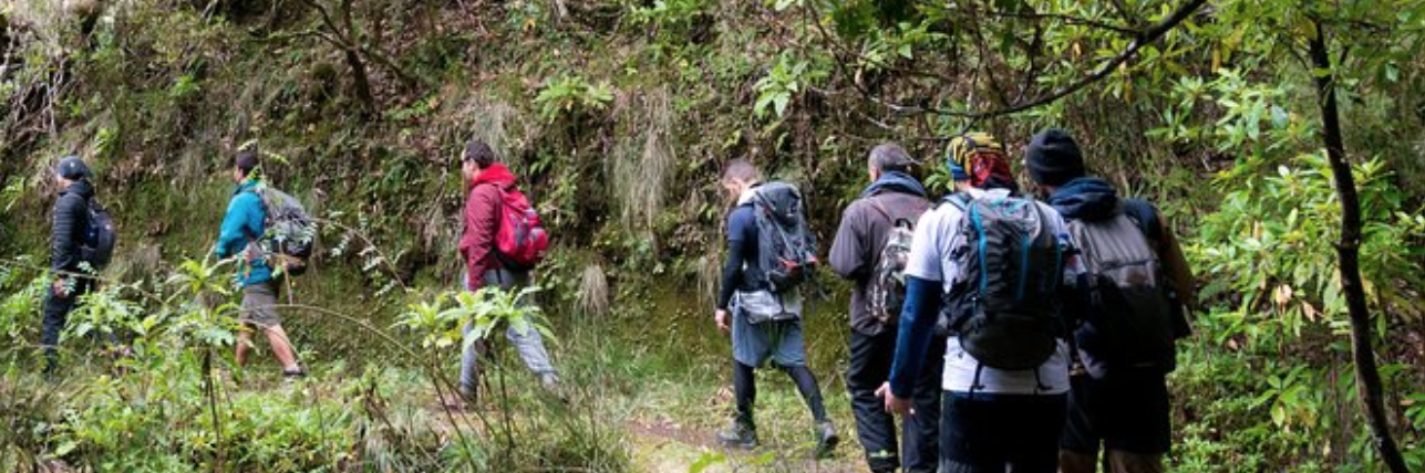
Water channels, waterfalls and the green landscapes of Madeira’s interior.

PR 6.2 · RABAÇAL
Levada do Alecrim
A levada landscape of green valleys, heather and water around Rabaçal.
About this visit & planning
Beginning near ER 105 at Rabaçal, the route follows the levada towards its source at Ribeira do Lajeado. The published route is 3.5 km each way, or 7 km out and back. The original guide highlights the Rabaçal and Ribeira da Janela scenery and the surrounding Laurissilva. Confirm the permitted route and access before walking.

PR 13 · LAURISSILVA FOREST
Vereda do Fanal
A walk through Madeira’s native forest towards the landscape of Fanal.
About this visit & planning
The official PR 13 runs from the Assobiadores area of Paúl da Serra to Fanal and is listed as 10.8 km, with moderate difficulty. This is different from the old page’s 19.5-km round-trip description. Plan transport around the actual start and finish; a short visit to the Fanal trees is not the same as completing PR 13.

PR 9 · QUEIMADAS
Levada do Caldeirão Verde
Forest, levada scenery and tunnels lead towards the dramatic waterfall landscape of Caldeirão Verde.
About this visit & planning
Starting in the Queimadas area, this route is known for narrow sections, exposed terrain and dark tunnels. Carry a headlamp and choose a route suited to your fitness and comfort with heights. The official description can include an extension towards Caldeirão do Inferno: confirm the exact section, distance and restrictions before planning your day.

PR 6 & PR 6.1 · RABAÇAL
25 Fontes & Risco
Two different waterfall walks in the Rabaçal landscape, featured together in the original guide.
About this visit & planning
PR 6 leads towards the 25 Fontes lagoon and its many springs; PR 6.1 leads to the Risco waterfall viewpoint. They share the Rabaçal area but have separate route descriptions and access arrangements. Combining them adds walking and climbing: do not treat the pair as a universally easy short walk. Allow time for steps, your return and any official route-direction instructions.
RIBEIRO FRIO · SHORT FOREST WALK
Vereda dos Balcões
3 km return · Easy · Around 1½ hours
A shorter walk alongside Levada da Serra do Faial, through the forest at Ribeiro Frio to the Balcões viewpoint.
About this walk & planning
The official route starts by ER 103 and runs for 1.5 km each way, returning along the same path. In clear weather, the viewpoint looks across forested valleys towards the central mountain range. Its shorter length adds an option for guests who do not want a long mountain hike. Check current conditions, access and reservation requirements before setting out.
SÃO JORGE · FOREST & WATER
Levada do Rei
10.6 km return · Moderate · Around 3½ hours
A levada walk from the Quebradas area of São Jorge towards Ribeiro Bonito and the green surroundings of the Laurissilva.
About this walk & planning
The official route is 5.3 km each way. It begins near the water treatment plant at Quebradas, passes agricultural and forest landscapes and continues towards Ribeiro Bonito. This is a longer outing than Balcões: allow time and energy for the return along the same route. Check the official route page for access, current conditions and booking requirements.
Peninsula & mountain walks
Different terrain, different demands: match the route to your experience and conditions.

PR 8 · EASTERN PENINSULA
Ponta de São Lourenço
Madeira’s eastern tip offers a striking contrast to the forest: open volcanic terrain and ocean views.
About this visit & planning
In the Caniçal area of Machico, the peninsula has low vegetation and little natural shade. The PR 8 route follows undulating coastal terrain with views of both sides of the island. Prepare for sun and wind, carry water and follow any signed diversions. Check the official route length and current access for your intended walk.

PR 1.2 · ACHADA DO TEIXEIRA
Vereda do Pico Ruivo
Mountain scenery on the approach to Madeira’s highest peak, Pico Ruivo.
About this visit & planning
For clarity, this card refers to PR 1.2 from Achada do Teixeira, listed as 2.8 km each way. It is not the longer approach from Ilha mentioned in the old page. Different routes reach the Pico Ruivo area; make sure your planned start point, return and booking match the route you intend to use.

PR 1 · CENTRAL MOUNTAINS
Pico do Areeiro to Pico Ruivo
Rocky ridges, tunnels and stairways through Madeira’s central mountain landscape.
About this visit & planning
Pico do Areeiro and Pico Ruivo are different peaks. The PR 1 connection passes through exposed and steep terrain. The official page distinguishes a shorter return section from a full connection that has specific direction and exit arrangements. Do not assume the full route can be walked out and back; confirm the current rules and organise onward transport.

PICO DO AREEIRO · PLANNING NOTE
Planning a Mountain Sunrise
The original sunrise photograph captures the appeal of being above Madeira’s clouds.
About this visit & planning
A sunrise viewpoint visit and a full mountain hike are different plans. Early starts can mean darkness, cold, poor visibility and strong wind. Use only permitted access, check the forecast and restrictions, and consider a qualified local guide if you are unfamiliar with mountain conditions. This photograph is not an assurance that a sunrise hike is available or suitable.
A few essentials for your day
- Wear footwear with grip, and bring layers and waterproof clothing.
- Carry water, food, a charged phone and a headlamp for routes with tunnels.
- Plan daylight, transport and your return; tell someone your route.
- Respect closures, signed diversions and barriers. Turn back if conditions are unsuitable.